1. Cat Ba Island
1.1. Overview of Cat Ba Island
Cat Ba Island, the largest of the 367 islands that make up the Cat Ba archipelago, is located on the southwestern edge of Ha Long Bay, about 30 kilometers from Hai Phong city. Covering an area of about 300 square kilometers, the island is a stunning combination of limestone mountains, tropical forests, mangrove wetlands, and white-sand beaches, a vivid map of the natural beauty of northern Vietnam.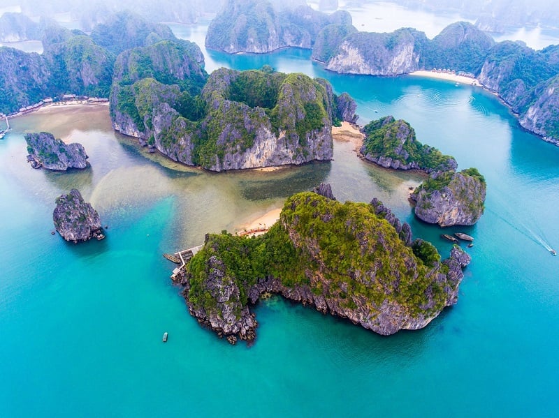 Part of the UNESCO-recognized Cat Ba World Biosphere Reserve, the island is renowned for its ecological richness. Cat Ba National Park, which covers nearly half of the island, is home to more than 1,500 plant and 282 animal species, including the critically endangered Cat Ba langur.
Explore the island with a Cat Ba Map that will help you discover diverse landscapes from forest-covered hills and hidden caves to coral reefs and quiet fishing bays, each with its own story of harmony between nature and people.
Today, Cat Ba Island is one of the most attractive destinations in Vietnam. With the Cat Ba Map in hand, every route becomes an opportunity to explore and connect.
1.2. Cat Ba Island Map
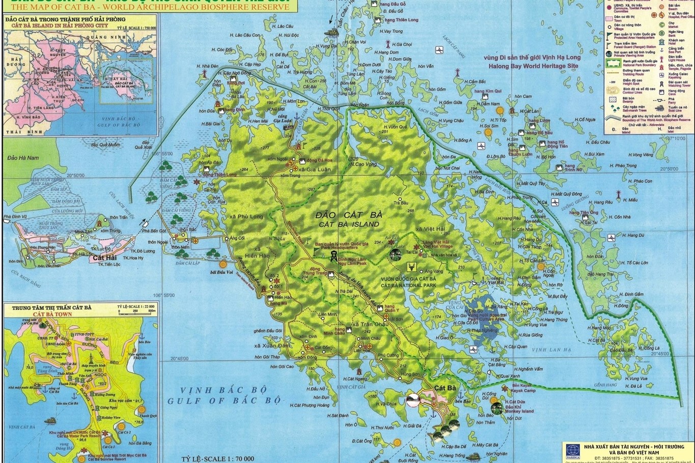 Looking at a map of Cat Ba, you will see that this island is located in the Gulf of Tonkin, ideally located between Hai Phong city and Ha Long Bay. This strategic location makes Cat Ba not only a natural wonder but also an ideal destination for tourists looking for adventure and tranquility. You can see the details of the Cat Ba Island Map
The Cat Ba Island Map reveals a diverse landscape, from the dense tropical forests of Cat Ba National Park to the limestone cliffs, hidden lagoons, and peaceful fishing villages dotted along the coast. Much of the island is part of the National Park, creating a rich and well-preserved ecosystem with many rare species of flora and wildlife.
Because of this unique geographical location, the Cat Ba Map makes it easy for visitors to identify key areas such as Cat Ba town, Lan Ha Bay and Cai Beo village,… then plan their journey from one place to another by motorbike, bicycle or boat.
1.3. Best Attractions In Cat Ba Island Map
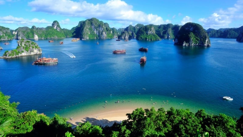
As you explore the Cat Ba Map, you will find that the island is full of stunning natural and cultural treasures waiting to be discovered. From dense forests and limestone peaks to peaceful villages and hidden bays, each stop offers a unique perspective on Cat Ba’s charm. Cat Ba National Park: Located in the center of Cat Ba Island, the UNESCO recognized national park boasts tropical forests, mangroves, coral reefs and limestone mountains. Visitors can hike to Ngu Lam Peak, kayak through peaceful lagoons or explore mysterious caves. It is also home to rare wildlife such as the golden-headed langur, making it a must-see destination for nature lovers.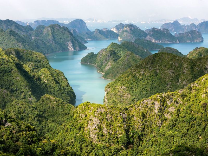 Lan Ha Bay: Located in the southeast of the island, Lan Ha Bay is one of the most beautiful destinations on the Cat Ba map. With over 300 limestone islands, hidden beaches and clear blue waters, it is an ideal place for kayaking, swimming and sightseeing. Don’t miss Cat Dua Island, Sung Sot Cave and Van Gia Fishing Village for unforgettable local experiences and stunning views.
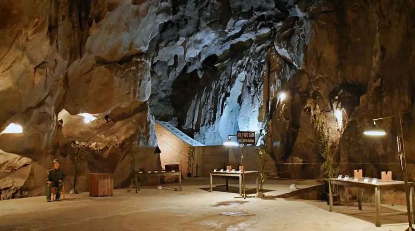
 Hospital Cave (Hang Quan Y): Hidden in the jungle north of Cat Ba town, Hospital Cave is a historic site that was used as a secret hospital during the Vietnam War. Cat Ba maps clearly state that the cave is located within the National Park area, offering visitors a fascinating combination of history and natural beauty.
 Ben Beo Port: As seen on the Cat Ba Island map, Ben Beo Port is the main gateway to Lan Ha Bay. It is a bustling harbor with boats, seafood restaurants and local markets. From here, you can easily take a day cruise or watch the sunset over the bay.
 Viet Hai Fishing Village: Deep in Cat Ba National Park, Viet Hai Village is a peaceful hideaway surrounded by limestone cliffs and lush greenery. Accessible by hiking, cycling or boating from Ben Beo Port. With its slow pace of life and friendly locals, this is one of the most authentic experiences on the Cat Ba map.
2. Cat Ba Town
2.1. Overview of Cat Ba Town
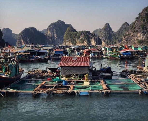
Beyond its unspoiled beauty, Cat Ba offers a glimpse into authentic coastal life. Cat Ba Town, located on the southeast coast of Cat Ba Island in the Gulf of Tonkin, is the administrative, cultural and tourist centre of the entire archipelago. Located about 30 km from Hai Phong City, the town is the main gateway for visitors to explore the beaches, limestone mountains and Cat Ba National Park. Millions of tourists both domestic and international come here every year, making tourism and related services the economic driving force of the town.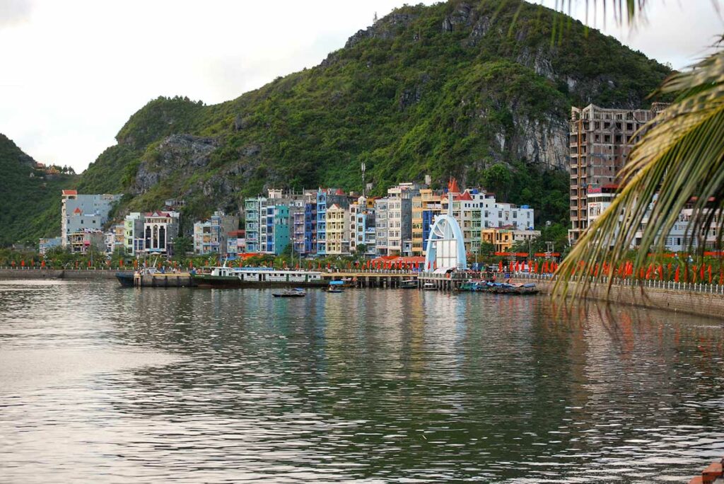 Nearby, Cai Beo fishing village offers a glimpse into a traditional way of life that has been preserved for generations. With the Cat Ba Map as your guide, you can easily explore cultural and natural highlights and discover local experiences that are less known to visitors.
The town offers a wide range of accommodation, from budget guesthouses to mid range hotels, concentrated mainly around the harbour area. This is also where most of the transport and tour services are located offering boat trips to Lan Ha Bay, kayaking tours and connections to Cat Ba National Park. You can easily rent a motorbike or bicycle to explore the nearby beaches and attractions, making Cat Ba town the ideal base for your island adventures.
2.2. Cat Ba Town Map
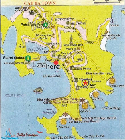 Cat Ba Town is the central area where most visitors arrive by ferry or speedboat from Hai Phong or Ha Long. Thanks to its convenient location, Cat Ba Town acts as a gateway to explore the rest of the island from Lan Ha Bay to Cat Ba National Park.
On the Cat Ba map, some key areas stand out clearly. The harbor area is the busiest, with many tourist boats, ticket offices and seafood restaurants. Just a short walk away are the main beaches of Cat Co 1, Cat Co 2 and Cat Co 3, which are the most popular relaxation spots for both locals and visitors.
The town center stretches along the coast with hotels, cafes and small shops, while inland roads lead to local markets and bus stations. The map also shows roads connecting the town with the northern and western areas of the island, making it easy to get to Cat Ba National Park or Viet Hai Village.
Using the Cat Ba Town map can help travelers plan their stay more effectively. Because most services from accommodations to restaurants are within walking distance, it’s easy to explore the town on foot or by renting a motorbike.
However, some older maps may not show recent developments, such as new hotels or construction projects along the coast. Therefore, visitors should check the updated version of the Cat Ba map or combine it with GPS tools such as Google Maps for high accuracy.
2.3. Best Attractions In Cat Ba Town Map
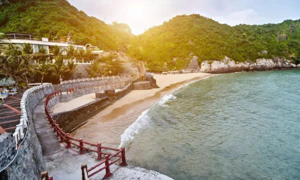
Cannon Fort (High Point 177): Just a short 3km drive from Cat Ba town centre, Cannon Fort is situated at an elevation of 177 metres above sea level and offers panoramic views of the harbour, town and surrounding bays. Old military bunkers and tunnels give the site a rich historical depth, while the hilltop viewpoint and cafe are ideal for watching the sunset.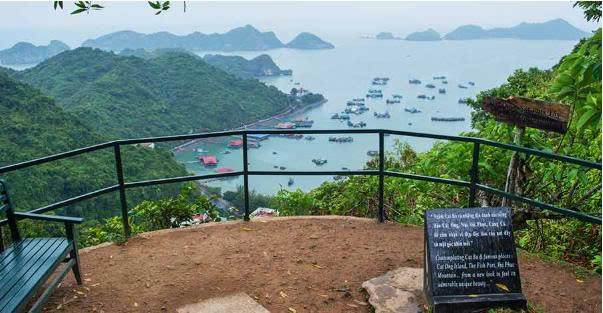 Cat Co Beach (Cat Co 1, Cat Co 2, Cat Co 3): Located right on the Cat Ba town map, the Cat Co beach cluster is one of the most accessible beach destinations from the city centre. These beaches have soft sand, clear blue waters and a more relaxed atmosphere than the larger resorts. From lively swimming areas to quiet coves just a short walk or drive away, there are flexible options for sunbathing, swimming or relaxing by the sea.
 Cat Ba Night Market & Town Centre Coastal Area: In the evening, the town centre coastal area becomes a vibrant hub of local culture: the night market comes alive with street food, souvenirs, local crafts and the daily rhythms of island life. With many restaurants specializing in seafood and local dishes, this is a great place to indulge in authentic local cuisine and socialise after a day of exploring nature.
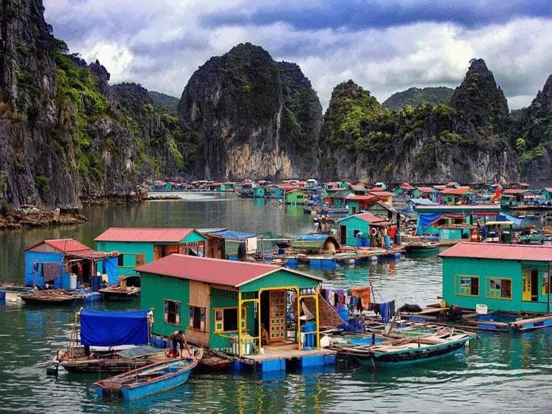
 Cai Beo Fishing Village: Located very close to the town and marked on many local maps, Cai Beo is one of the oldest floating fishing villages in Vietnam. From Cat Ba town, a short boat or motorbike ride takes you to this unique community to see floating houses, fish farms and traditional life on the water. It is both a scenic and cultural highlight, creating a contrast with the natural attractions.
